
EDITORIAL – Proposed new riding boundaries make no sense
(Image: Federal Electoral Boundaries Commission)
An editorial by Mel Rothenburger.
DRAWING LINES ON A MAP is easy, especially for electoral boundary commissions.
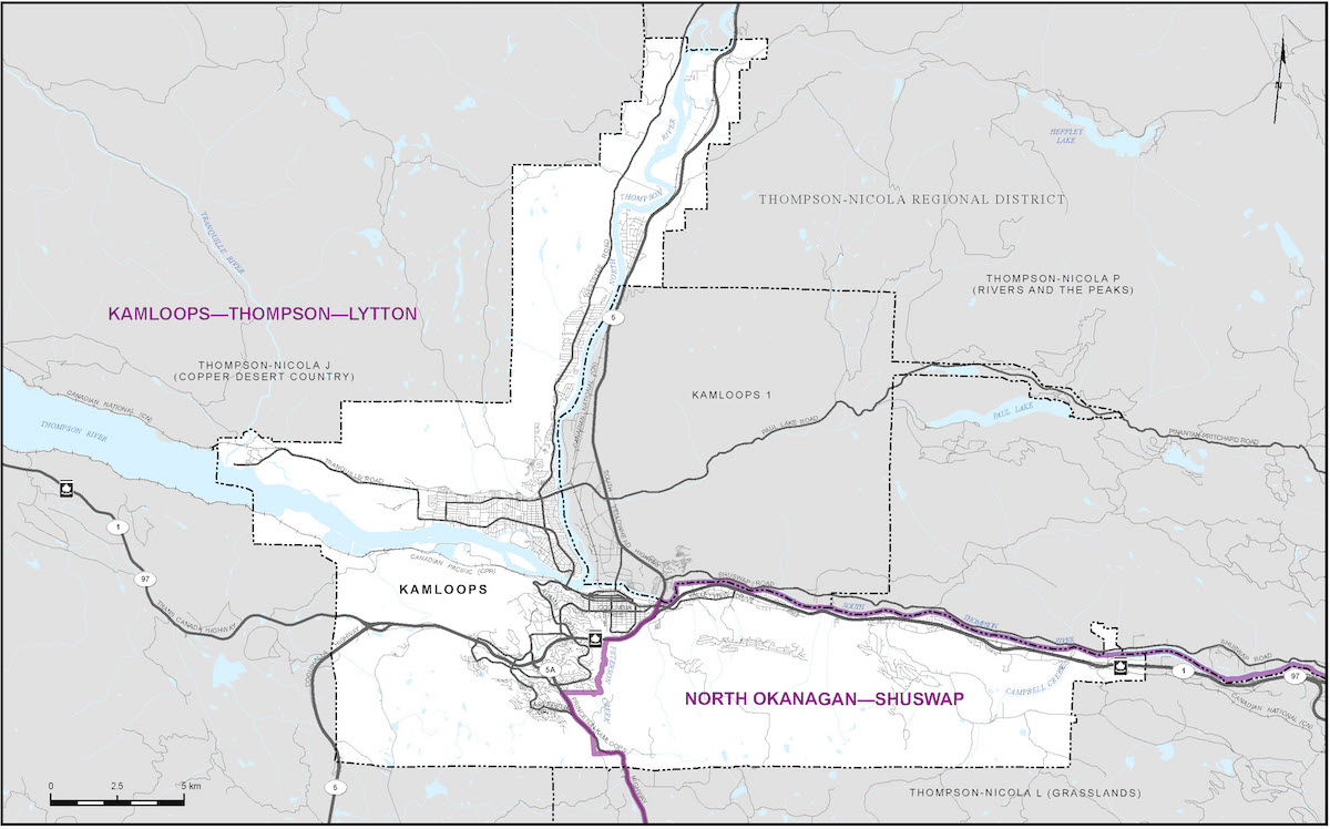
A new federal electoral map is being drawn up and one of the initial proposals is to split the city of Kamloops and attach the two pieces to separate ridings.
The main populated area of the city, including Aberdeen and the North and South Shores, would be part of a riding called Kamloops-Thompson-Lytton, while an area stretching from Valleyview along the South Thompson River would be in a riding called North Okanagan-Shuswap.
The Federal Electoral Boundaries Commission is tasked with splitting B.C. into 43 ridings with 116,300 people each, more or less. A review is done every 10 years — between 2011 and 2021, the province grew from 4.4 million to five million people, creating some challenges in keeping distribution relatively equal.
Mel Rothenburger is a former mayor of Kamloops and a retired newspaper editor. He is a regular contributor to CFJC Today, publishes the ArmchairMayor.ca opinion website, and is a director on the Thompson-Nicola Regional District board. He can be reached at mrothenburger@armchairmayor.ca.

Leave a comment