
Snow keeps falling, freezing rain next?
NEWS/ WEATHER — Southern Interior residents are being advised to postpone non-essential trips after a day-long dump of heavy snow hit the region Sunday, creating hazardous conditions.
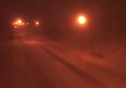
Peterson Creek Bridge weather cam just after 11 p.m. Sunday.
The snowfall began early in the day and continued throughout the afternoon and evening. Environment Canada said the snow would continue overnight, with snowfall accumulations ranging from 15 to 45 centimetres across a broad swath of the Southern Interior.
A break in the snow is expected early Monday morning before the next Pacific system deposits a further five to 15 centimetres late Monday. And, there’s a 60 per cent chance of more snow through Tuesday.
TRU will keep an eye on the weather overnight before deciding whether to close the campus Monday.
The university issued a weather alert early Sunday evening that it will announce by 6 a.m. Monday if the campus needs to be closed.
School District 73 is also doing a weather watch, with an announcement expected Monday morning on whether any schools will be closed.
The Arctic air in the valley bottoms is being slowly mixed with milder air moving in at the level of the mountain-tops.
The storm will deliver heavy snow — up to 50 cm — to the Coquihalla through Monday. Drivers were told Sunday night to chain up.
Drive B.C. issued a travel advisory Sunday night for the Yellowhead Highway 5 between Kamloops and Clearwater due to limited visibility caused by blowing snow. Travellers were advised to make other plans or allow for additional time to reach their destinations.
And there’s more bad news — with more overrunning warm and moist air expected and temperatures persisting below zero in the valleys, freezing rain may develop Tuesday.

Leave a comment